
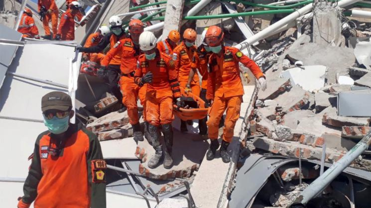
Indonesia Earthquake devastation spread across Flores and other parts of East Nusa Tenggara on Saturday, August 15, 2026, after a powerful magnitude 7.7 earthquake struck offshore, killing at least 38 people. The shallow earthquake damaged homes and public facilities, triggered deadly landslides, disrupted roads and communications and forced thousands of residents from their homes. Authorities initially issued a tsunami warning, prompting coastal evacuations, before lifting the alert after relatively small waves were recorded. Rescue operations remain critical as teams work to reach affected communities and search areas hit by landslides.
Table of Contents
Where was the Indonesia Earthquake Center?
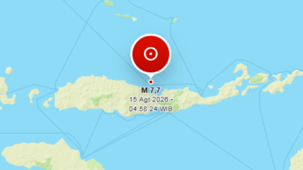
Indonesia’s Meteorology, Climatology and Geophysics Agency, known as BMKG, placed the earthquake about 30 kilometers northeast of Mbay in Nagekeo, East Nusa Tenggara. BMKG recorded a magnitude of 7.7, a depth of 15 kilometers and coordinates of 8.41 degrees south and 121.39 degrees east.
(BMKG, Dr. Wijayanto, August 15, 2026, Gempa Bumi M7,7 – 30 km TimurLaut MBAY-NAGEKEO-NTT) (https://www.bmkg.go.id/gempabumi/berpotensi-tsunami/20260815050954)
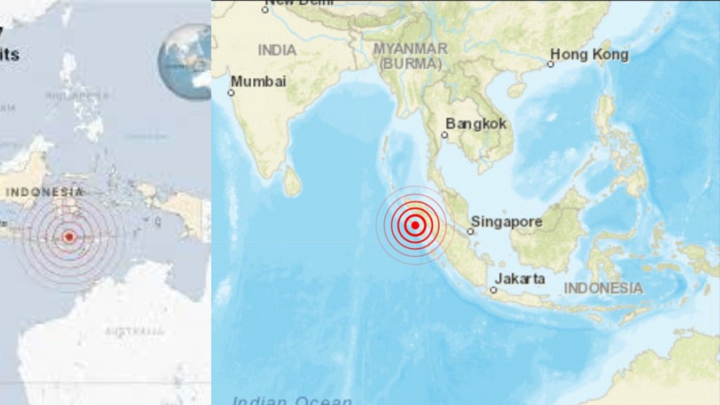
The earthquake struck at 5:09 a.m. local western Indonesian time, according to BMKG. Its shallow depth increased the potential for strong surface shaking close to the epicentral region.
Different seismic agencies can produce slightly different preliminary locations and depths because they use separate monitoring networks and calculation models. The central facts remain consistent: a very powerful and shallow tectonic earthquake struck offshore near Flores, close enough to populated areas to cause severe damage.
Death Toll Reaches at Least 38
The human impact became clearer as rescue teams reached damaged communities.
The death toll from the Indonesia Earthquake has risen to at least 38. Indonesia’s disaster authorities also reported 13 injured, including 2 people with serious injuries and 11 with minor injuries, while around 2,000 residents moved to safer areas. Rescue operations continued across affected parts of Flores as teams searched damaged buildings and landslide zones.
(Reuters, August 15, 2026, Magnitude 7.7 earthquake strikes off Indonesia’s coast, killing at least 38) (https://www.reuters.com/business/environment/magnitude-69-earthquake-strikes-off-coast-indonesia-emsc-says-2026-08-14/)
The casualty count may still rise as rescue teams reach isolated communities and complete assessments in areas affected by blocked roads, landslides and communication disruptions.
Buildings and Public Facilities Damaged
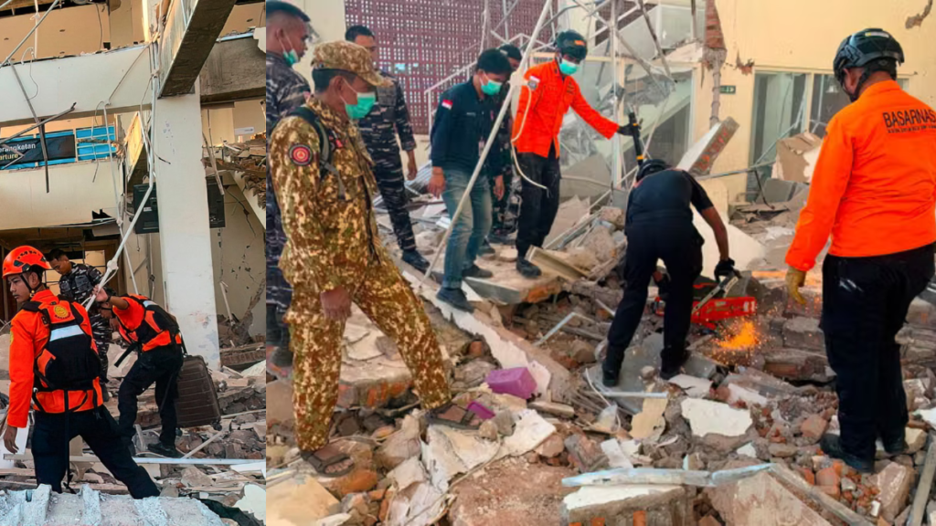
The Indonesia Earthquake damaged homes, government buildings and public facilities across Flores. At Maumere port, a waiting area collapsed, while Ritapiret Seminary in Sikka suffered roof damage during morning Mass.
Key damage reported includes:
• 🏚️ Homes and public buildings damaged across affected areas
• 🚢 A waiting area collapsed at Maumere port
• ⛪ Ritapiret Seminary sustained structural damage during morning Mass
• 🏥 Some hospitals moved patients and medical equipment outdoors
• 🚧 Damaged infrastructure and blocked access slowed emergency response
The scale of structural damage added pressure on rescue teams already dealing with landslides, aftershocks and communication problems.
Landslides Block Critical Roads
The Indonesia Earthquake triggered landslides across Flores, blocking roads and making it difficult for rescue teams to reach some of the communities closest to the epicenter.
The access crisis created several immediate problems:
• 🚧 Landslides blocked roads leading toward Nagekeo, restricting access to the regency closest to the epicenter.
• 📵 Communication signals were disrupted, making it harder to assess conditions in affected communities.
• ⛴️ A second rescue team attempted to reach the affected area by ferry after land access became difficult.
• 🚑 Blocked routes complicated efforts to move rescuers and emergency assistance into isolated areas.
(Reuters, August 15, 2026, At least 38 dead after Indonesia’s magnitude-7.7 earthquake, officials say) (https://www.reuters.com/business/environment/magnitude-69-earthquake-strikes-off-coast-indonesia-emsc-says-2026-08-14/)
Restoring access remains critical as rescue teams search for survivors and authorities assess damage in communities affected by the earthquake and landslides.
Why Did the Indonesia Earthquake Happen?
BMKG classified the event as a tectonic earthquake. Flores sits within a highly active and complex tectonic region where movement between major plates and smaller crustal blocks continually builds stress.
The United States Geological Survey has previously described the Flores Sea and wider Banda Arc as a complex zone shaped by convergence involving the Australian and Sunda plates. The Australian plate moves northward relative to the Sunda plate, while several faults and tectonic structures accommodate movement across the region.
(U.S. Geological Survey, December 14, 2021, M 7.3 – Flores Sea) (https://earthquake.usgs.gov/earthquakes/eventpage/us6000gc2a/executive)
When accumulated stress exceeds the strength of rock along a fault, the crust can rupture and release energy as seismic waves. In this case, the shallow offshore earthquake produced intense shaking across nearby islands.
The broader tectonic setting explains why Flores experiences major earthquakes, but identifying the precise fault mechanism responsible for the August 15 event requires detailed event specific seismic analysis.
Tsunami Warning Issued and Later Lifted
The offshore location and magnitude initially raised concern over a possible destructive tsunami.
BMKG issued a tsunami warning following the Indonesia Earthquake, prompting residents in vulnerable coastal communities to move toward safer locations.
Monitoring stations subsequently detected tsunami waves. BMKG reported approximately 0.94 meters at Maurole in Ende, 0.38 meters at Pelabuhan Kewapante in Sikka, 0.36 meters at Labuan Bajo and 0.25 meters in Flores Timur.
After reviewing observations, BMKG officially ended the tsunami warning at 7:31 a.m. WIB on August 15.
(BMKG, August 15, 2026, Gempa Bumi M7,7 – 30 km TimurLaut MBAY-NAGEKEO-NTT) (https://www.bmkg.go.id/gempabumi/berpotensi-tsunami/20260815073130)
The lifting of the warning removed the immediate tsunami threat, but residents still faced damaged buildings, landslide risks and aftershocks.
Flores Has a History of Destructive Earthquakes
Flores has experienced catastrophic seismic disasters before. Its location within Indonesia’s active tectonic environment leaves the island exposed to earthquakes and tsunami hazards.
A devastating earthquake and tsunami struck Flores in 1992, killing large numbers of people and destroying coastal communities. The disaster remains an important part of the region’s experience with earthquake preparedness.
Indonesia as a whole lies across one of the world’s most active seismic regions. Preparedness depends on resilient construction, functioning warning systems, clearly understood evacuation routes and rapid public access to official information.
Kocean24 also follows major natural events and their effects on communities, including its coverage of the 2026 total solar eclipse and other significant science and environment developments.
(Kocean24, August 12, 2026, Solar Eclipse 2026: Europe Prepares for a Rare Celestial Spectacle) (https://kocean24.com/solar-eclipse-2026-europe/)
What are the Critical Priorities Now?
Search for Missing People
Locating anyone trapped or missing remains the most urgent priority. Landslide areas require careful search operations because unstable ground can also endanger rescue personnel.
Restore Access to Isolated Areas
Clearing blocked roads is essential for moving rescuers, medical teams, food, water and equipment. Alternative transport may be required where landslides have made roads unusable.
Inspect Damaged Buildings
Homes, hospitals, schools and public facilities need structural assessment before people return. Aftershocks can turn already weakened buildings into serious hazards.
Support Evacuated Residents
Around 2,000 people were reported displaced in Nagekeo alone. Temporary shelter, clean water, food, sanitation and medical care become increasingly important as displacement continues.
Monitor Aftershocks
Further seismic activity remains a concern. Authorities need to monitor aftershocks while residents stay clear of unsafe buildings and landslide prone areas.
Conclusion
The Indonesia Earthquake has left at least 38 people dead and caused serious damage across parts of Flores, with collapsed structures, landslides, blocked roads, evacuations and disrupted communications complicating the emergency response. The tsunami warning has been lifted, but the danger has not completely passed as aftershocks and damaged infrastructure continue to threaten affected communities. Rescue teams now face the urgent task of finding missing people, reaching isolated areas, restoring critical access and supporting displaced families while authorities establish the full scale of the disaster.