
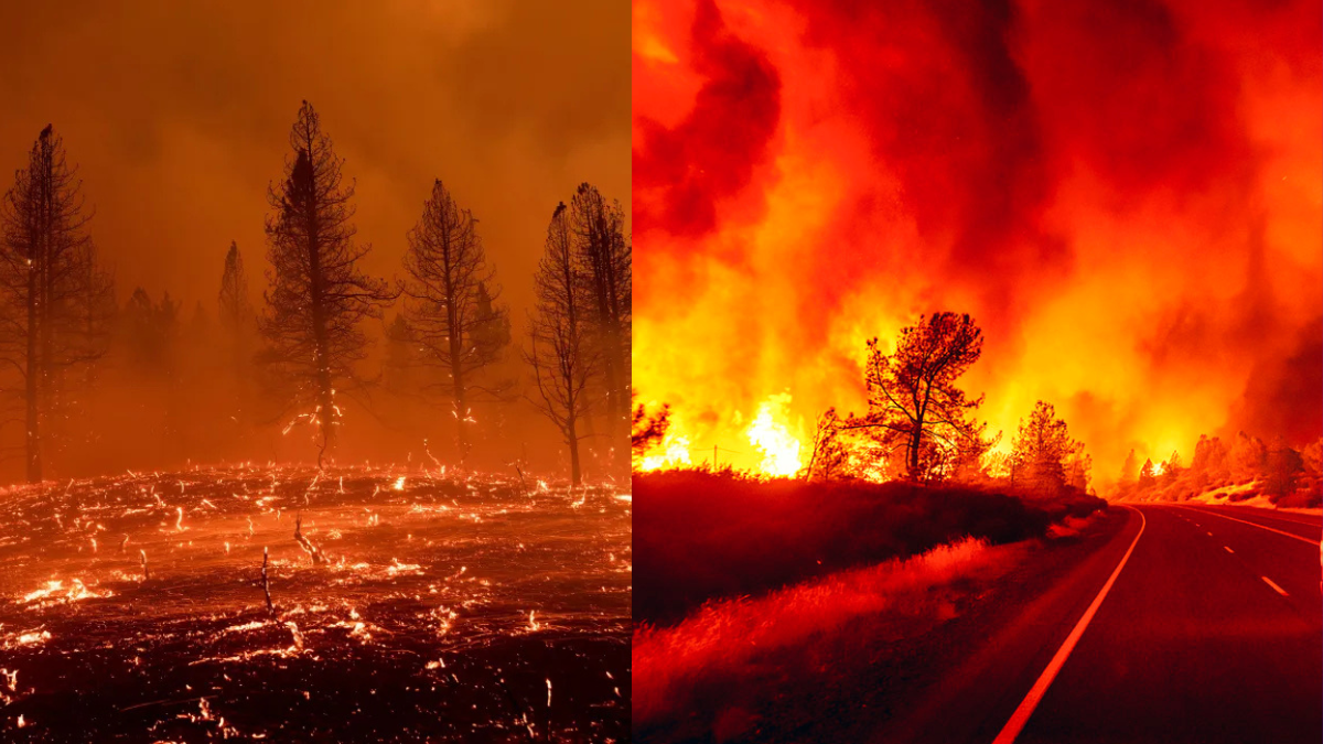
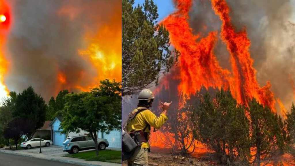
California Bug Fire activity intensified rapidly near the Nevada border on Saturday, August 8, 2026, transforming a relatively small vegetation fire into a major wildfire emergency within hours. Flames spread near the U.S. 395 corridor as authorities ordered evacuations across threatened communities and firefighters mobilized resources from multiple jurisdictions.
The extraordinary speed of the fire has become one of the biggest concerns. Thousands of acres burned within hours, evacuation zones expanded and highway travel faced disruption. Residents around Cold Springs and neighboring communities are now closely following emergency instructions as crews work to control the wildfire.
Table of Contents
California Bug Fire Reaches 6,528 Acres within Hours
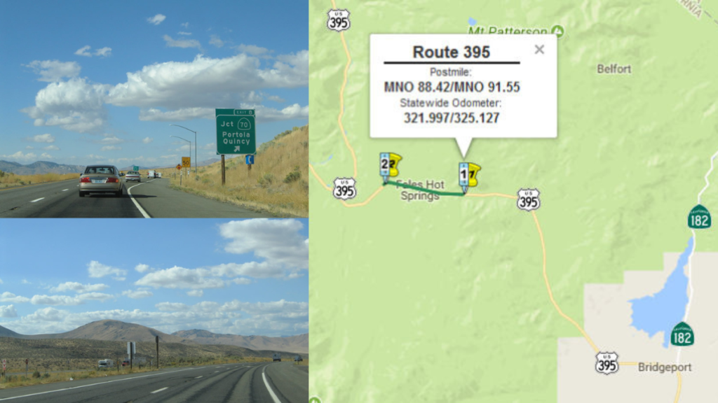
The California Bug Fire started Saturday afternoon east of U.S. Route 395 and south of Bringman Road in Lassen County. Initial estimates placed the wildfire at approximately 50 acres shortly after 4 PM.
Growth accelerated dramatically afterward. The fire reached approximately 800 acres by early evening before FIRIS intelligence aircraft mapped it at 2,467 acres at 6:37 PM. Another mapping placed it at 4,182 acres at 7:11 PM. By 11:49 PM, FIRIS mapping showed the fire had expanded to 6,528 acres. Officials said the cause remained under investigation.
(CAL FIRE, August 8, 2026, Bug Fire) (https://www.fire.ca.gov/incidents/2026/8/8/bug-fire)
The numbers reveal the extraordinary pace of expansion. A wildfire initially measured at approximately 50 acres grew beyond 6,500 acres during the same afternoon and evening, dramatically increasing the challenge facing emergency crews.
Evacuations Expand around Cold Springs
Multiple Communities Face Evacuation Orders
The California Bug Fire quickly became a direct threat to communities as flames advanced toward populated areas in Washoe County, Nevada.
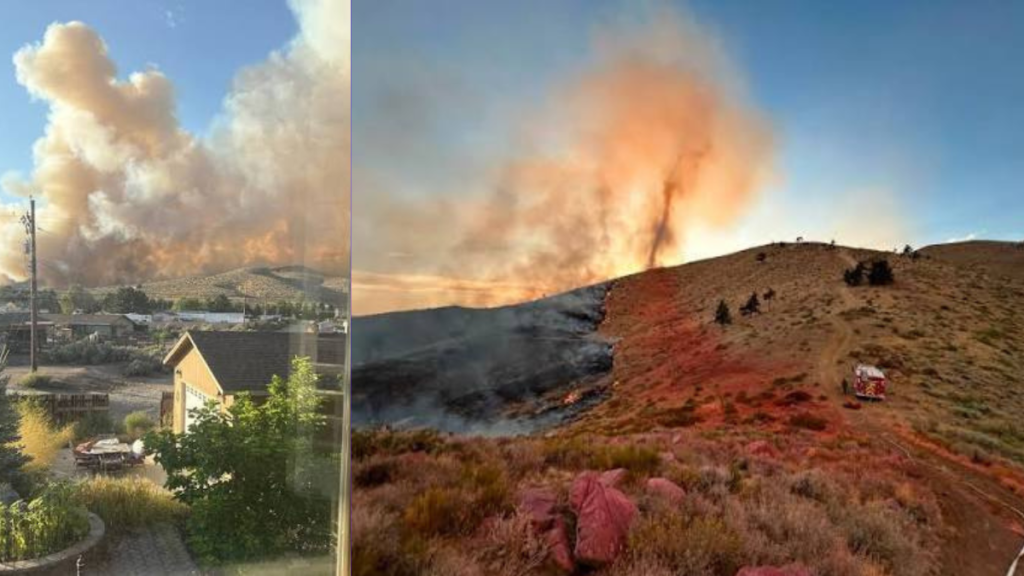
Evacuation orders affected areas including Cold Springs, Canyon Hills, White Lake, Silver Knolls and locations north of Cold Springs. Authorities opened the Evelyn Mount Community Center at 1301 Valley Road in Reno for evacuees. The Reno Livestock Event Center was designated as a location for large animals affected by evacuations.
Local reporting confirmed the fire had reached an estimated 6,528 acres as evacuation orders expanded in Cold Springs and Silver Knolls. Nevada Highway Patrol also closed northbound U.S. 395 exits at White Lake and Village Parkway as emergency operations continued.
(2 News Nevada, 2 News Nevada Digital Team, August 8, 2026, Bug Fire grows to 6,500+ acres, evacuations ordered in Cold Springs and Silver Knolls) (https://www.2news.com/news/local/bug-fire-grows-to-6-500-acres-evacuations-ordered-in-cold-springs-and-silver-knolls/article_2cdc0eb9-1d73-4963-a2fc-de088885f846.html)
Residents covered by evacuation orders should follow instructions from emergency authorities immediately. Wildfire conditions can change rapidly, making early evacuation especially important when flames are approaching populated areas.
U.S. 395 Disrupted by California Bug Fire
The location of the California Bug Fire makes transportation another significant concern. U.S. 395 serves as an important route through the California and Nevada border region, placing highway traffic close to the emergency.
The wildfire began north of Bordertown near the agricultural inspection station along U.S. 395. California Highway Patrol reported traffic restrictions near the Nevada state line during the response, while Truckee Meadows Fire and Rescue urged motorists to avoid the affected area.
Officials reported no structures lost and no injuries as of the Saturday night update. Since the fire remained active and continued growing afterward, those figures represented conditions at the time of reporting rather than a final damage assessment.
(News 4, Alisabeth Mitchell, August 8, 2026, Bug fire grows to more than 4,100 acres; no structures lost or injuries reported) (https://mynews4.com/news/local/crews-battle-brush-fire-along-us-395-near-hallelujah-junction-at-california-nevada-line)
Highway disruption adds another challenge for emergency teams. Authorities must protect communities while keeping evacuation routes accessible and preventing motorists from entering dangerous areas.
Regional Firefighters Join the Response
The California Bug Fire required assistance from firefighting agencies beyond the immediate incident area as its footprint rapidly expanded.
Carson City firefighters were among the crews sent to assist with the response near Cold Springs. Regional agencies mobilized resources while separate fire activity was also demanding emergency attention elsewhere in western Nevada.
(Carson Now, Jeff Munson, August 8, 2026, Brush fire prompts evacuations south of Gardnerville; Carson City firefighters sent to Bug Fire near Cold Springs) (https://www.carsonnow.org/08/08/2026/brush-fire-prompts-evacuations-south-of-gardnerville-carson-city-firefighters-sent-to-bug-fire-off-us-395-near-cold-springs)
Cooperation between agencies is particularly important near a state border. Wildfires can move across administrative boundaries, requiring departments to coordinate personnel, equipment, evacuation operations and public safety information.
Why the Rapid Expansion Matters
The California Bug Fire is concerning not only because of its acreage but also because of how quickly it reached that size.
Going from approximately 50 acres to 6,528 mapped acres within hours fundamentally changed the emergency. Authorities had to manage expanding evacuation zones, transportation restrictions and firefighting operations while aircraft continued mapping the evolving perimeter.
Extreme environmental conditions can also turn ordinary situations into serious public safety challenges with little warning. Kocean24 previously examined another weather related emergency involving extreme heat in Washington DC and its impact on public activities.
(Kocean24, Alex Hamilton, July 5, 2026, How Washington DC Heat Wave Disrupts 4th of July Celebration) (https://kocean24.com/washington-dc-heat-wave/)
Preparedness becomes especially important when conditions are changing quickly. Residents should depend on official emergency alerts rather than waiting until smoke or flames become visible from their homes.
What Happens Next with the California Bug Fire?
The California Bug Fire remains at 6,528 acres with 0% containment in the latest official incident listing, leaving containment progress, evacuation changes and fire growth as the most important developments to watch. Residents north of Reno remain directly affected by the emergency.
The immediate situation includes:
- 🔥 Containment: The latest official listing shows 6,528 acres and 0% containment.
- 🚨 Evacuations: Orders have been issued for areas in Cold Springs and Silver Knolls.
- 🏘️ Community risk: The fire is burning northwest of Cold Springs near the California and Nevada border.
- 🔎 Investigation: No confirmed cause has been announced.
- 📍 Next update: New perimeter mapping and evacuation changes will show whether firefighters are gaining ground.
KOLO reported evacuation orders in Cold Springs and Silver Knolls as the Bug Fire burned north of Reno, with emergency officials responding to the expanding wildfire.
(KOLO 8 News Now, Brenna O’Boyle and Ben Deach, August 8, 2026, Bug Fire burning north of Reno grows to more than 4,100 acres) (https://www.kolotv.com/2026/08/09/evacuation-orders-effect-areas-north-cold-springs-officials-say/)
With containment still at 0%, the next official acreage, containment and evacuation updates will determine whether the emergency is stabilizing or continuing to expand.
Conclusion
California Bug Fire remains a serious threat after rapidly expanding to 6,528 acres near the Nevada border. Evacuations show how quickly this emergency has affected nearby communities. Firefighters are working to contain the flames while residents await safer conditions. The coming hours could prove crucial as crews fight to protect lives and homes.